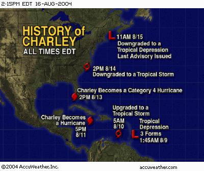
Hurricane Charley had been brewing in the Caribbean for several days. Just another named tropical storm moving up into the Gulf of Mexico... or so we thought. Charley began to strengthen, moving across Cuba and skirting the Florida Keys before heading up the coast to a projected landfall near Tampa.
Tampa Bay residents were ordered to evacuate as the storm took aim on the Tampa-St. Petersburg area. Many of those evacuating came to Orlando to seek shelter. Based on Charley's projected track, Orlando would be about 90 miles east of the center as it passed through Tampa. Orlando expected rain and wind, but no serious damage from the passing storm.
Early Friday afternoon Charley quickly strengthened into a Category 4 hurricane, took a right turn and blasted into the southwest Florida coast near Punta Gorda. The new projected path took direct aim at Orlando, 100 miles away.
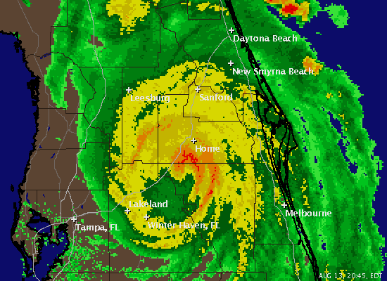
Charley hit Orlando Friday night. The center passed almost directly over our house around 9:15. Wind gusts reached 105 miles per hour. Judy and I took shelter on the kitchen floor between cabinets, about the only place in the house with protection from flying glass. The wind howled. Rain and lake water blew in sheets against the windows. Electric power went out. Total darkness. Just wind and rain and the sound of breaking limbs.
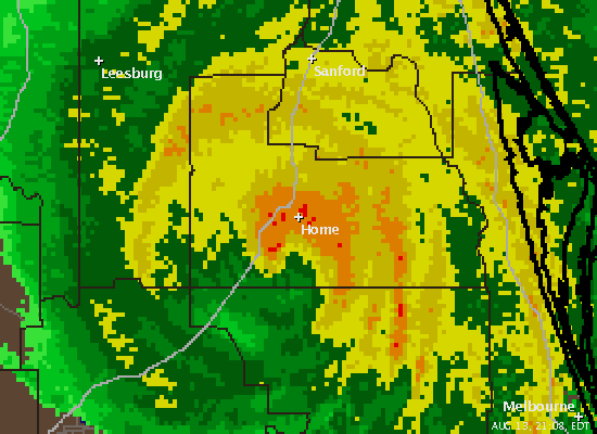
These Doppler radar images were captured on my notebook computer. Although the electricity was off, strangely cable Internet service was still up. My wireless network was still working on battery backup.
8:45 PM - Charley hits Home
9:08 PM - Dead Center
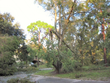
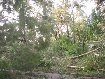
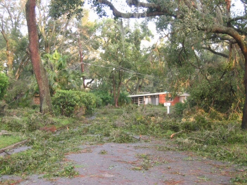
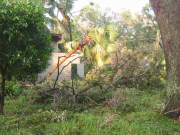
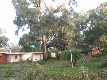
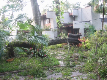
The following pictures were taken within two blocks of our home early Saturday morning. The amount of damage was incredible. Trees down, power lines coiled like spaghetti, houses damaged. We are extremely thankful to have had no serious damage to our home.
Our hearts go out to the people of southwest Florida who lost everything to Charley.